Progress report for GNC23-366
Project Information
Evaluating smooth sumac (Rhus glabra) management in rangelands through development of high-resolution GIS maps
Globally, woody encroachment — the expansion of woody species — is threatening grasslands. In Nebraska, grasslands provide essential rangeland for cattle, the state’s third-greatest exported product. Where rangelands have been impacted by woody encroachment, livestock production has decreased by 75%. Maintaining rangelands by curbing woody species expansion is critical.
Objectives and Rationale
Smooth Sumac (Rhus glabra) is a woody, resprouting shrub of increasing concern due to its rapid spread throughout rangeland and resistance to management approaches, according to ranchers and land managers. This project will produce GIS maps of north-central Nebraska, a key livestock production region. The maps will test hypotheses about sumac encroachment drivers and management effects. Maps and project findings will be shared through extension publications and virtual workshops aimed at ranchers and land managers. Collaborations with producers, land managers, extension educators, and state conservation biologists have been essential in shaping this project.
Approach
The high-resolution (~1 m resolution) map will show what rangeland has the most sumac encroachment. The map will combine USDA-NAIP imagery with ground-based data collected in collaboration with ranchers and land managers. Using machine learning, we will develop a sumac classifier that locates sumac in NAIP imagery across the region. The classifier will also be used with historical NAIP imagery to quantify rates of sumac encroachment concerning environmental conditions, topography, and management variables.
Outcomes and Evaluation
This project will increase rancher awareness of problematic sumac in grasslands and rangelands, and how ranchers can preserve rangeland quality. Virtual workshops will be held to train users on sumac encroachment maps, gain feedback from producers and managers, and convey results. This project will be evaluated in pre-and post-workshop surveys with questions targeting knowledge of sumac encroachment, management methods, opinions toward the species, and intent to implement sumac management. Findings on historical sumac distributions and their relationship to environment and management will be published in an extension report and scientific publications. Critically, this project will produce an open-access sumac encroachment map to give ranchers and land managers tools to identify areas most at risk of further sumac encroachment and to target management efforts. The use of the map will be evaluated with a web counter.
This project is important for ranchers to quantify sumac spread, understand encroachment drivers, and utilize effective controls, allowing ranchers to better preserve rangeland quality, increase profit, and maintain livestock.
This project will have the following learning and action outcomes:
- Ranchers will be more informed about smooth sumac encroachment rates on their rangelands. Through workshops and partnerships with ranchers, this project will increase awareness of how problematic sumac is for grasslands and rangelands, how this species responds to management efforts, as well as how sumac encroachment rates have changed over time. Increased awareness will be evaluated in a pre-and post-workshop survey, using questions targeting knowledge of sumac encroachment, management methods, and attitudes toward the species.
- Findings on historical sumac distributions and their relationship to environment and management will be published in an extension report and scientific publications.
- The action outcome is that ranchers and land managers will be able to use the sumac encroachment map developed in this project to identify areas most at risk of further sumac encroachment and to select the most effective management techniques, depending on the environmental context, in an evidence-based way. The use of the map as well as the online GIS data layer that makes up the map will be assessed using an online counter tracking the number of times the map and GIS layer have been accessed. Additionally, the intention to manage sumac will be assessed in a post-workshop survey sent six months after the workshop. Through partnerships and workshops, I aim to at least 50 ranchers during this project and create open-access sumac evaluation products that can be used by many more.
Research
Objective 1: Census sumac patches across rangeland to build a ground-based dataset
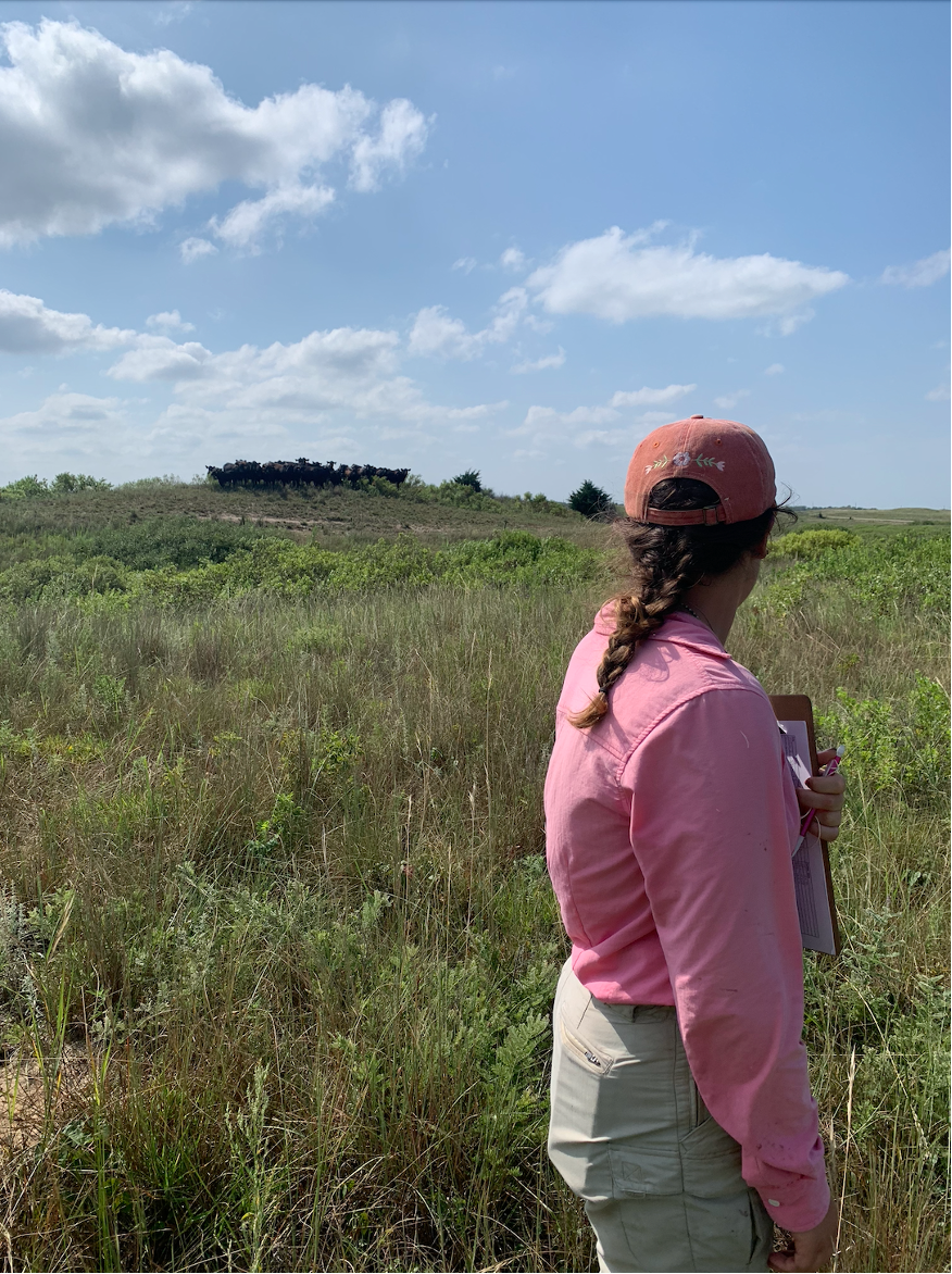
Rangeland properties with sumac patches were located across north-central Nebraska during summer 2024 through discussions with land manager-partners at the Nature Conservancy, and the Nebraska Native Plant Society, and the UNL Extension Office. I connected with ranchers and landowners to facilitate land access permissions, learn the management history of the properties (i.e. cutting, herbicide application, prescribed fire), and identify locations of sumac patches.
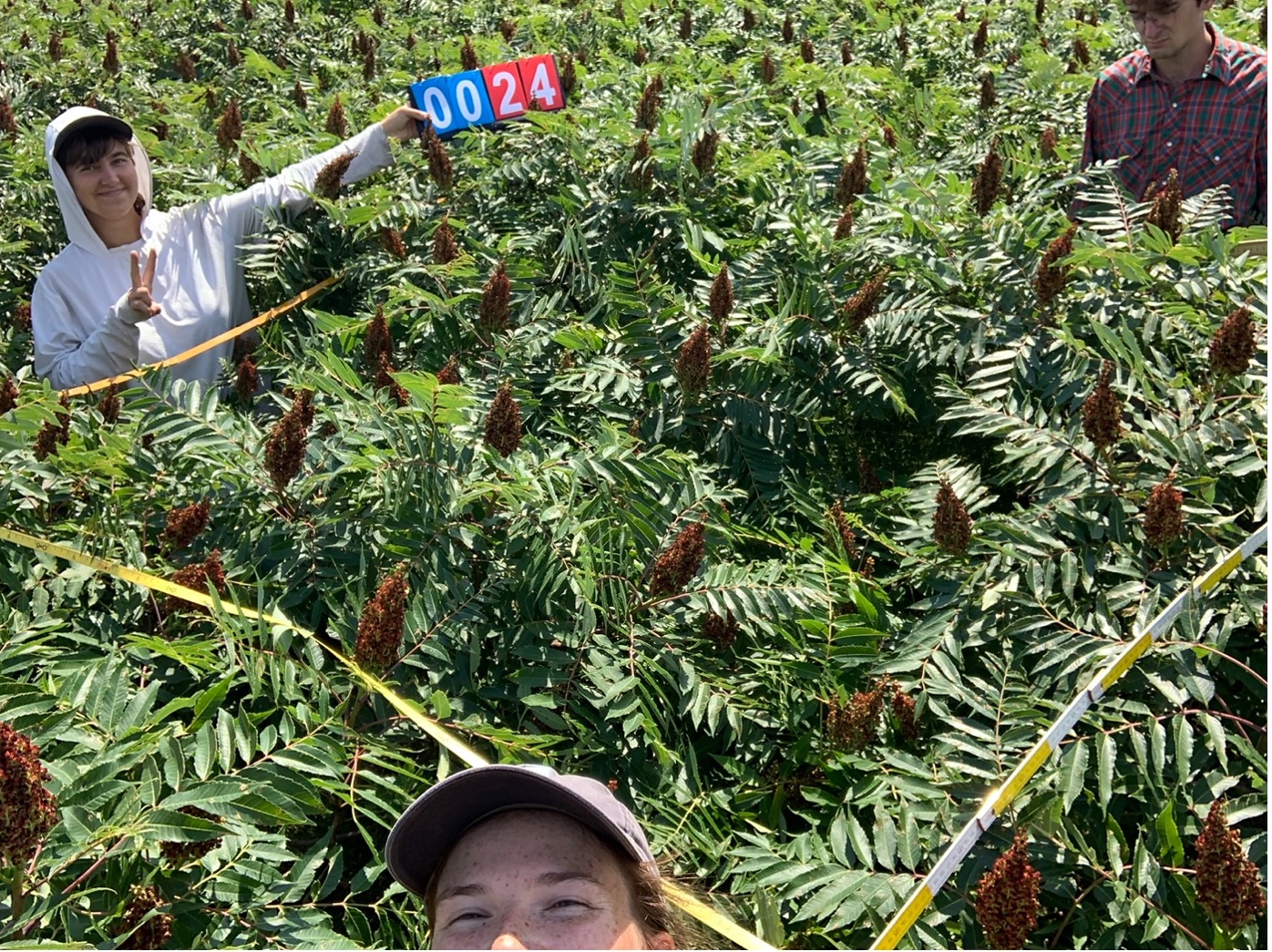
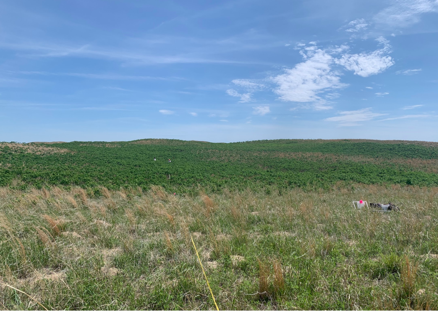
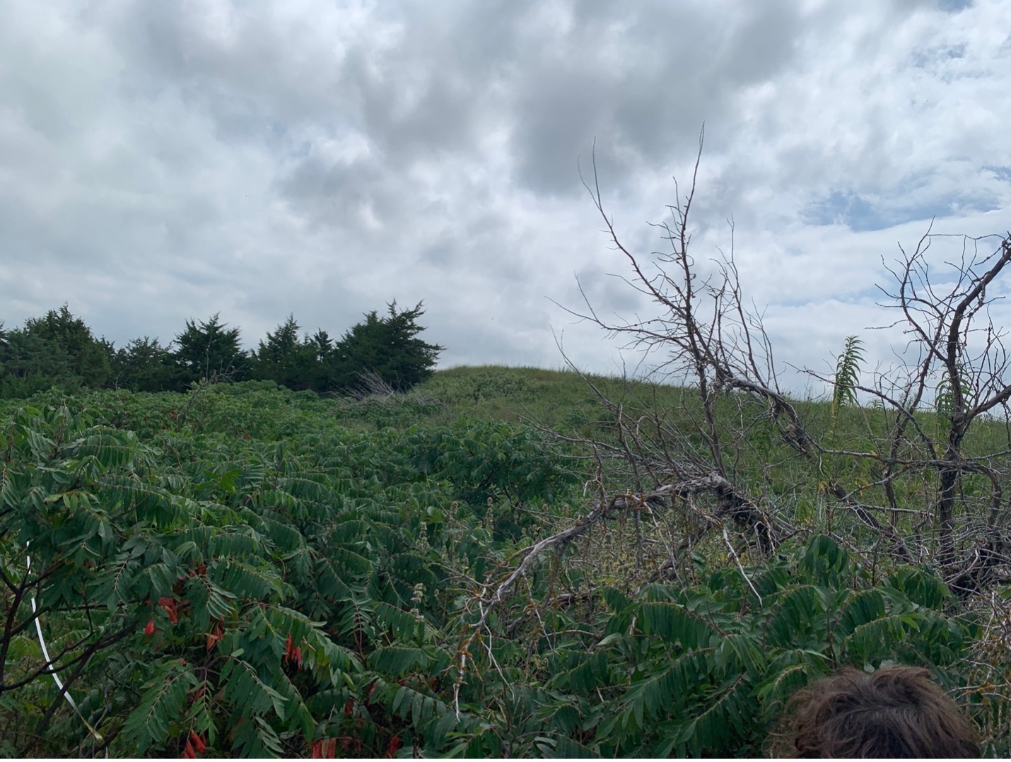
With 3 field technicians, I visited a total of 9 properties across 6 Nebraska counties in north-central Nebraska for ground truthing. Sumac patches of different sizes and stem densities were sampled by placing a transect with equally spaced 2m x 2m quadrats ~10m apart spanning the width of the patch. The quadrat size was selected to fully encompass the spatial resolution of USDA-NAIP imagery (~0.6 – 1 m spatial resolution). NAIP imagery has four bands, is collected every other year, and is designed to capture information about vegetation during growing season. At each quadrat, we georeferenced the location with a high-accuracy GPS and estimated sumac density as the percent cover of sumac within the quadrat. The number of sumac stems and percent cover of non-sumac woody species, herbaceous species, and bare ground were recorded. We also recorded the location and approximate size of ground cover that could be spectrally similar to sumac (deciduous trees, plum thickets, poison ivy patches, etc.). This information will be important for evaluating image classification accuracy. Photographs were taken of each quadrat for reference. In total, we sampled 877 quadrats.
The ground truthing data collection was timed to align with Nebraska’s most recent NAIP acquisition. The most recent NAIP imagery in Nebraska was acquired and received during the summer of 2024 and as of 2/26/2025 has not yet been inspected or released. Once the 2024 data is available, the next step of training the machine learning algorithm can begin.
I have made progress on the following products:
- GIS layer for smooth sumac detection in north-central Nebraska: Ground truthing has been completed from the 2024 growing season, aligned with the 2024 Nebraska NAIP flights. I am currently awaiting the availability of 2024 NAIP imagery to begin training a machine learning algorithm to identify sumac cover.
- An extension report and publication on land management and topography impacts on sumac expansion: I have compiled land management histories for the nine ground truthed rangeland properties documenting prescribed fire, mowing, herbicide, and no treatment as sumac management strategies. GPS locations collected during the ground truthing will allow me to evaluate topography once I have generated the sumac encroachment map.
- Workshop and presentations targeting 50 ranchers and land managers: I attended the Nebraska Grazing Convention in Kearney, NE, where I discussed sumac encroachment with ranchers. I also attended and presented about smooth sumac in the sandhills at the Nebrasksa Natural Legacy Conference in North Platte, NE, engaging with land managers and people working in conservation in Nebraska. To date, I have engaged with 15 ranchers, 30+ land managers, and established connections with the Nebraska Extension Office to coordinate future outreach efforts once the encroachment map is complete.Based on my conversations with ranchers, I developed a survey to quantitatively assess the impact of smooth sumac. This survey will be used in future presentations and workshops. The questions include:
- How concerned are you about sumac encroachment on your property?
- For how long have you been concerned about sumac on your property?
- How much do you estimate that your livestock-related income has been affected by sumac encroachment?
- How much do you estimate non-livestock-related income has been affected?
- How much additional expenditure has sumac encroachment caused?
- Compared to other unwanted plant species, how difficult do you find sumac removal?
Nearly all 15 ranchers I spoke with were impacted by woody encroachment, including eastern redcedar (Juniperus virginiana), smooth sumac (Rhus glabra), and fragrant sumac (Rhus aromatica). Ranchers and land managers noted that sumac encroachment appears to be primarily affecting the eastern Sandhills and areas near rivers, while the western Sandhills remain largely unaffected. Some ranchers reported that sumac has been present in their pastures for as long as they can remember but has expanded in the last 20 years. Management techniques like cutting and burning are ineffective due to sumac’s clonal nature, which allows it to resprout from below-ground buds and rhizomes. Ecologically, this gives smooth sumac a competitive advantage over non-clonal woody species like eastern redcedar, which is also more easily removed. One rancher has been treating woody plants, including sumac, in his pasture for 15 years. Another used aerial herbicide spraying in 2023 and plans another treatment in 2025, which are costly treatments. Overall, the consensus is that woody encroachment from sumac is increasing on some properties, and smooth sumc is more difficult to manage than other woody species. However, there is not a clear reason for the expansion, highlighting the need for further investigation into environmental and management effects.
Educational & Outreach Activities
Participation summary:
With 3 field technicians, I visited a total of nine properties belonging to seven ranchers across six Nebraska counties in north-central Nebraska for data collection. In total, the field crew spent roughly 20 days collecting data at these properties. I also attended two conferences: The Nebraska Grazing Convention to learn about ranching concerns, and The Nebraska Natural Legacy Conference to present about smooth sumac encroachment in the Nebraska sandhills. Between data collection and the conferences, I have discussed sumac encroachment with 15 ranchers and 30 land managers.
Once the encroachment map is developed, I will be running workshops and presenting in the fall about how sumac encroachment has responded to management and topography and has changed over time. I will also be writing a report over the results of the sumac encroachment map.